Giant rock at Grammer Grove: Geology lesson
Glacial boulders in Iowa exist in many of our landscapes that have a history of multiple glacial events. One such boulder lies exposed along a small upland creek drainage at the Grammer Grove Wildlife Area.
It is just one feature of this public park that helps draw visitors. They can ask a simple question — “How did this big rock get here?”
It is a valid question for those inquisitive minds who want to learn more about Iowa’s landforms. So buckle up as we go for a ride through time, lots of glacial history time, to explore Earth’s huge natural climate fluctuations that formed continental sized thick ice sheets.
These multi-thousand feet thick ice domes came down from Canada many times, an estimated 33 times during the last 2.6 million years. Geologists have studied the landscapes of North America, particularly those of Canada and northern portions of the United States from Washington State to Maine.
Everywhere they looked, evidence pointed to an undulating but rather level landform and old lake shorelines now hundreds of feet above current lakes or river systems, and high on the adjacent hillsides, they would find large isolated boulders out in the middle of nowhere. People were curious as to the origin of these very large boulders.
Scientists did figure out the answers by following the evidence, and locating those source points for the granite rocks hundreds or even thousand or more miles north in the Canadian shield bedrock. Scientists deduced that glacial ice plucked these rocks and lots of other debris off the land as the ice formed, got thicker and thicker over thousands of years, and finally under its tremendous weight, began to slowly creep southward.
Embedded in the glacier were lots of rocks and rock fragments, and those rocks, if at the base of the glacier, scraped along the ground surface to scratch any underlying rocks, and scratch its own surface, leaving deep parallel grooves. Once the glacial ice had advanced as far as that ice episode was going to go, a naturally re-warming earth caused the ice to melt. All debris within the ice cap simply fell out, littering the landscape with tell tale signs of a past ice event.
Those rocks left behind were described as “peculiar, irregular and uncommon.” Geologists call them erratics, meaning they were carried from the place of origin and then left stranded by melting ice. One clue was that the composition of the erratic was not from a local source.
Most glacial erratics of Iowa can be found in north central and northeast Iowa. Does southern Iowa have such large boulders? Yes, but they mostly lie buried very deep under a thick cover of wind blown silts, called loess (pronounced ‘luss’).
When found, many big boulders are exposed by the erosion action of streams and rivers over long periods of time. The big rock at Grammer Grove is exposed because the small stream flow of water nearby eroded the soils that once had buried this rock. It is a matter of coincidence that our modern day park has this huge boulder within its boundary.
Time wise, Grammer’s boulder did not arrive during the last glacial event known as the Wisconsinan. That ice event covered north central Iowa after its arrival from Canada and Minnesota, areas west of Marshall County, and that time frame was only about 14,000 years ago.
There were many other older glacial episodes and one of those, either during what glaciologists call the Kansan or pre-Illinoian events, could be the ice event that brought the boulder south. In any case, it happened. Between each glacial event maximum, tending to last about 100,000 years, there were shorter interglacial warm periods in which the ice melted.
The leading edge would have appeared to retreat by melting action. Over thousands of years, the ice margin finally would work its way farther and farther north and end up in what is now Hudson Bay, Manitoba, and all that fresh water from the glacier would be impounded at the
glacier’s toe forming immense temporary lakes. Drainage water would spill out eventually as it did into what is now Lake Superior, Michigan and other great lakes.
Back on the recently exposed land surface, absent any ice, tundra vegetation claimed the parent material soils. That was followed over long time frames by boreal forests, and then a mix of hardwoods.
Over more time, these forests gave way to more and more grasses as the long-term climate became dryer and warmer. Onto the open landscapes of the Midwest came the American Indians, then later settlers who wanted to farm. Farmers wanted to clear fields of any rock obstacles.
Rocks could be moved to form fences, or just to get them out of the way. Some glacial boulders were used as foundation stones for homes and barns. Even today, these rocks are still evident in Iowa along fence rows or field corners, disposed of in out-of-the-way locations.
Glacial rocks are easy to identify. They are mostly igneous or metamorphic, not sedimentary, sandstone, limestone, dolomite or shale in composition. Glacial erratics are mostly made of interlocking crystals of pink feldspar and glassy quartz.
These rocks for sure came from outside the state and got here locked in glacial ice. These rocks also appear rounded from being rolled and bumped prior to being locked in ice. Also, they may have beveled surfaces or even smooth sides which during the course of their journey were ‘sanded off’ just like what we could do with sandpaper to an odd shaped block of wood.
With enough time and effort, we could sand one surface to a smooth contour. Rocks carried by rivers with high flow rates also can round off the corners of any rocks moved by high speed currents.
Grammer Grove’s big boulder is about 20 feet long, about 15 feet wide and above ground about 10 feet. Estimates of its volume and weight would be a good science project.
Using a similar stone of a small size to be handled by people, submerge it in a tank of water. Measure the water level before and after immersion, calculate the displacement volume, then weigh the stone from your experiment.
Now try to estimate how many units of known weight are within this huge boulder. My best guess is several hundred thousand tons. Are there any takers to this experiment?
Other large partially exposed glacial boulders exist in Iowa in Black Hawk County near Waterloo. It was measured at 30 feet long, 20 feet wide and 27 feet high. It was broken up in 1891 to use chunks of it to build the First Presbyterian Church.
Another boulder in Floyd County, three miles west of Nashua, was considered the largest known erratic in Iowa. It was 50 feet long, 40 feet wide and 11.5 feet above ground.
Nobody knows how deep this rock is below ground. Saint Peter’s Rock is located four miles southeast of Alta Vista in Chickasaw County, and yet another is west of Cedar Falls in Grundy County.
Each glacial erratic has a story to tell, a piece of the geological history of our state, the origins of the rock and its journey to where it now rests. Check out the big rock at Grammer Grove for yourself soon.
This Fourth of July weekend would be perfect. Enjoy.
——–
July has arrived ladies and gentlemen, boys and girls. One half of the year 2023 is already history, time past.
For this new month, we will see a sunrise on the first at 5:38 a.m. Sunset was at 8:50 p.m. for a day length of 15 hours and 12 minutes. By the 31st, sunrise will have shortened to 6:02 a.m., and sunset will be at 8:31 p.m. for a day length of 14 hours 30 minutes. We will lose 42 minutes of daylight.
Also during July, on the 6th, the Earth will be at its farthest distance from the Sun. It is called Aphelion.
For fishermen and fisher ladies, you probably already know that 80 percent of the game fish are located in only 20 percent of the stream. Therefore you will have to move often to find them.
If you think our present warm temperatures were “hot,” well, try this on for size. Atlantic, Iowa, had a 117 degree air temperature on July 25, 1936, and when temperatures get hot, people flocked to lakes and water sources.
Sadly, on July 28, 1929, nine people died on West Lake Okoboji as the result of a boat accident. Be careful out there.
——–
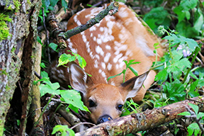
Pheasant hens have been seen with their hatch of little ones. Same thing for hen turkeys. Same thing for white-tail deer as new fawns figure out how to live in their new world.
One contact told of seeing three fawns single file follow the doe deer into heavy cover. Another reader of Outdoors Today asked what to do about a new fawn in his backyard in Marshalltown? I told him to do nothing, just watch and observe. Finally a few days later, the fawn was gone.
Overnight the doe deer came to take care of her offspring in the way Mother Nature has prescribed. All of these are cool sightings.
——–
Garry Brandenburg is the retired director of the Marshall County Conservation Board. He is a graduate of Iowa State University with a BS degree in Fish & Wildlife Biology.
Contact him at:
P.O. Box 96
Albion, IA 50005
-

- PHOTOS BY GARRY BRANDENBURG — Iowa’s landscapes have a deep glacial history with many clues to its ancient past. One clue are those seemingly random scattering of small, medium and sometimes very large granite boulders. Farmers across the Midwest had to contend with these rocks while early farm life required driving teams of horses, then later with tractors pulling implements. If the rocks were small enough to move toward a fence row, it was accomplished. Sometimes these glacial erratics were just too large to move, so the alternative was to farm around them, and leave them alone. Today’s image is of a huge granite boulder located at the Grammer Grove Wildlife Area. This public area is located about three miles southwest of Liscomb, on the hilly terrain of the east bluffs near the Iowa River. Read on to find out the rest of the story and something you might not know.