What’s down there?

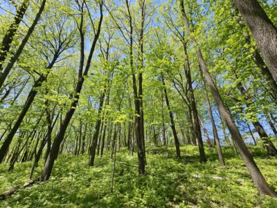
T-R PHOTO BY GARRY BRANDENBURG Limestone quarries are very numerous and supply crucial building products from roadstone to many products used to construct homes. Larger limestone rocks are used to protect lake shoreline edges from eroding water wave action caused by wind. County gravel roads have a top layer of crushed limestone. Ag lime is used by farmers to help control pH levels of their soils. Limestone products also help cleanse and purify drinking water. Each year Iowans use about 35 million tons of crushed limestone. Today’s photo was made near Gifford by this author last week while flying south along the Iowa River. The quarry is an interesting site, not just for what it produces, but also for its geological history of rock layers laid down in ocean basins long long ago.
BY GARRY BRANDENBURG
LIMESTONE is a key essential natural resource. So that is why you as a reader will get a tiny drop of facts related to this type of stone under our feet. It is when we have the opportunity to drive past a limestone quarry, and if the roadway elevation allows us a view inside, that our curiosity may be enticed to learn more. For me as a private pilot, I get the eagle eye point of view often. The bigger picture as illustrated by today’s photo, allows you to see what is down deep in the ground.
Thanks to Mother Nature and eons of geologic time, many ancient ocean advancements of long duration allowed dissolved chemicals in the water to precipitate downward. Slowly they accumulated and compacted, tiny layer by layer into total thicknesses of hundreds of feet thick.
Of course if one keeps digging, or could dig deep enough, we could expose a slice of the earth’s history from the crust surface, then into the mantle and finally to earth’s nickel core. It would be like taking a big wedge out of the earth to look at what it is made of.
Luckily geologists have developed numerous methods to study and compare rock layers all over the earth. Then add in how plate tectonics, volcanism, glaciation systems rise and fall, and ocean advancements over the land and subsequent retreats have shaped our earth over time frames so ancient over the 4.5 billion years of existence as the ‘third rock from the sun.’
If one can imagine a big layer cake in the shape of Iowa, with a thin frosting layer on its top (soil), then underneath the soil are ancient subsoils of glacial till. Under that you would come to the top surfaces of bedrock for many hundreds of feet. Below that will be the basement rocks of igneous clastics and plutons and gneisses from deep earth molten sources and by products of ancient volcanic events and former weathered away mountain ranges.
Let us explore this hypothetical layer cake of Iowa a bit. Once it is out of the oven, and cooled, we are going to cut it with knife from it northeast corner near the Mississippi River in a straight line diagonal to the southwest corner of Iowa at the Missouri River. Now imagine opening the cake so you and I can view its rock layers of various types. What would we find?
First, the cake pan must be not quite level, as the rock layers exposed at the surface in Allamakee County are buried 3,000 feet deep at Hamburg, IA. We can thank lots of earth crust deformation for that. What does not change are those rock layers, many being limestone origin and dolomite, with names such as Mississippian aquifer, upper Devonian shales, Devonian aquifer and then specific limestone sub family groups like Lower Maquoketa, Galena, Prairie du Chein, St. Lawrence formation and Cambrian aquitard. If it sounds a bit complicated it is.
The Gifford Quarry is about 270 feet deep at it lowest points. All the layers of limestone above that hole have been used in construction activities in Hardin, Marshall or surrounding counties. As the mine removed material, the hole got wider and a systematic process of layer removal keeps bringing limestone to the surface for crushing into various sizes, screening, sorting and stockpiling it for sale to construction companies. To keep the hole dry enough, a pumping system runs 24/7 to pump ground water out of the pit and back into the Iowa River. If the pump fails, the entire pit would eventually fill with water.
Limestone products obtained may not seem like they are essential to improving our lives, but they are. Many of Iowa’s 19th century bridges and buildings were built of limestone quarried at places where overburden soils were not too thick.
This allowed early mining operations access to the rock. Railroads needed rock for bridges and road grade. Highways have basis materials of road stone to allow for drainage. Cement can be made from some limestone.
Deep in many quarries in Iowa, rock layers of time are exposed for our “reading,” if we can learn a tad about geology, earth history and gain an improved appreciation for time in millions of years. In general, the top layers of bedrock are the youngest and everything below that is progressively older and older and older. The specific ages of each rock layer can be determined by lab tests, fossil remnants and other collaborating data. It is good that geologists have allowed and shared what they know so we can learn what’s down there.
MONARCH BUTTERFLIES are making a grand appearance. The Marshall County Conservation Board staff continues to involve the public in capturing a few of them, tagging them and allowing these beautiful insect critters to be released on their southward journey to the mountains of central Mexico. This particular stage, the fourth, is programmed in its tiny brain to travel over land it has never seen before. The internal road map is hard wired for a route to follow. This scribe has seen many monarch in the past two weeks. I’m sure more will be accumulating and staging for a big push on it long journey. May their efforts be successful. To learn more about tagging butterflies, call the MCCB at 641-752-5490.
BIRD MIGRATION notes were made last week, at least for a few species. I had the pleasure of viewing a Baltimore Oriole this week. Its orange and black feathered body was taking grape jelly out of the feeding station. Sept. 7 is the average departure date for this species. In wetland habitats, look for King Rails and Greater Yellowlegs to be gone by Sept. 25. Common Terns should have passed by the 20th. Yellow-billed and Black-billed Cuckoos may be here until about the 25th.
How does one find these critters? First, learn where their preferred habitats are and then go to such places with binoculars in hand and good mental or written notebook for recording entries. A good bird book in your backpack will help work through details of plumage as might be seen in the fall season. You can take this hobby to any level desired if that is your choice. Make good use of any and all natural habitat types, woodlands, wetlands, prairies, backyard settings or even roadsides. Do make use of county conservation managed public lands. Admission is free. The experience can be priceless. What you may learn can last forever. Just thank Mother Nature for making it all possible.
” It is the friends we meet along the way that help us appreciate the journey.”
— anonymous
——
Garry Brandenburg is a graduate of Iowa State University with BS degree in Fish & Wildlife Biology. He is the retired director of the Marshall County Conservation Board. Contact him at PO Box 96, Albion, IA 50005.